This article was published in the Nov/Dec 2018 issue of Trek & Mountain magazine
…
Bordered by the mountains of Afghanistan to the south, Uzbekistan to the west, Kyrgyzstan to the north and China to the east, Tajikistan is a small, land-locked country nestled in the centre of Asia.
Though often overlooked, it is one the most impressive hiking and trekking destinations in the world. To give you an idea of just how impressive, here are a few stats: 93% of Tajikistan’s land area is mountainous. A country smaller than the UK, Tajikistan is home to over 2,000 lakes and over 8,000 glaciers, including the largest glacier in the world outside the polar regions. As well as many 6,000m peaks, it boasts three peaks over 7,000 meters, including Ismoil Somoni at 7,495m, previously known as Communist Peak, which was the tallest mountain in the Soviet Union. It is a country with a lot to offer, and with increased investment in the kind of infrastructure that will accelerate the growth of tourism (along with other businesses), Tajikistan is gradually opening up; connecting the world with the many traditional communities that are scattered across it.
Our destination was the Fann Mountains in the west of the country, part of the western Pamir-Alay mountain system, and just a few hours from the capital, Dushanbe. The range is in a 300 kilometre square reserve that is packed with hiking routes and contains about a hundred peaks, with several rising to altitudes of more than 5,000m. Drier, relatively lower, and more accessible than its eastern counterparts along the Wakhan Corridor, the crowning jewels of the area are the many icy-cold glacial lakes and rivers which are found throughout the territory, and which boast some of the most clear and striking mountain waters you could imagine.
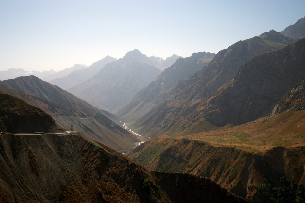
To get to the start point, we left Dushanbe heading north, quickly arriving alongside the Varsob river. After just an hour we were already high in the mountains, flanked by steep, rugged valley walls pockmarked with bushes, cracks and dry wrinkles.
Snaking into the heart of the mountains we passed grey cliffs, hay-coloured pinnacles and open mountain faces with a strange pinkish hue that were striped by thick red bands. Found at the centre of the Silk Road, in ancient times Tajikistan was famous for its rich deposits of gold, silver, lead, precious and semiprecious stones, such as noble corundum, ruby, noble spinel, turquoise, lapis lazuli, and amethyst. I later found out that Tajikistan in one of the few countries in the world where you can find almost every element on the periodic table. Perhaps it’s this unusual geological variety that underpins the formation of such dramatic scenery.
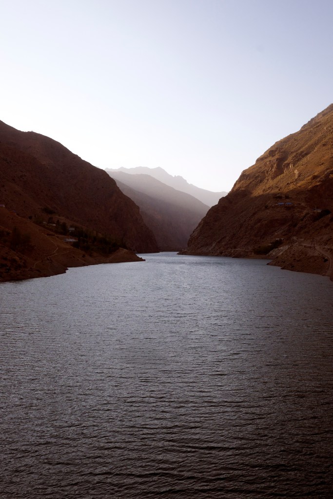
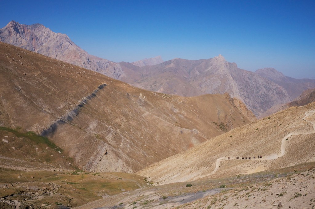
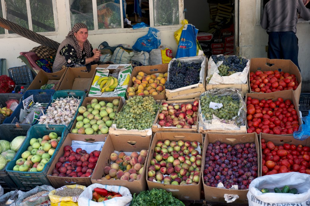
After crossing the Yagnob river we traced the valley and stopped at Sarvoda, a little market town by a bridge, where we bought fruit and vegetables and swapped cars for a more robust 4×4. The last part of our journey by car was only a few kilometres, but the road was so difficult that it took over an hour.
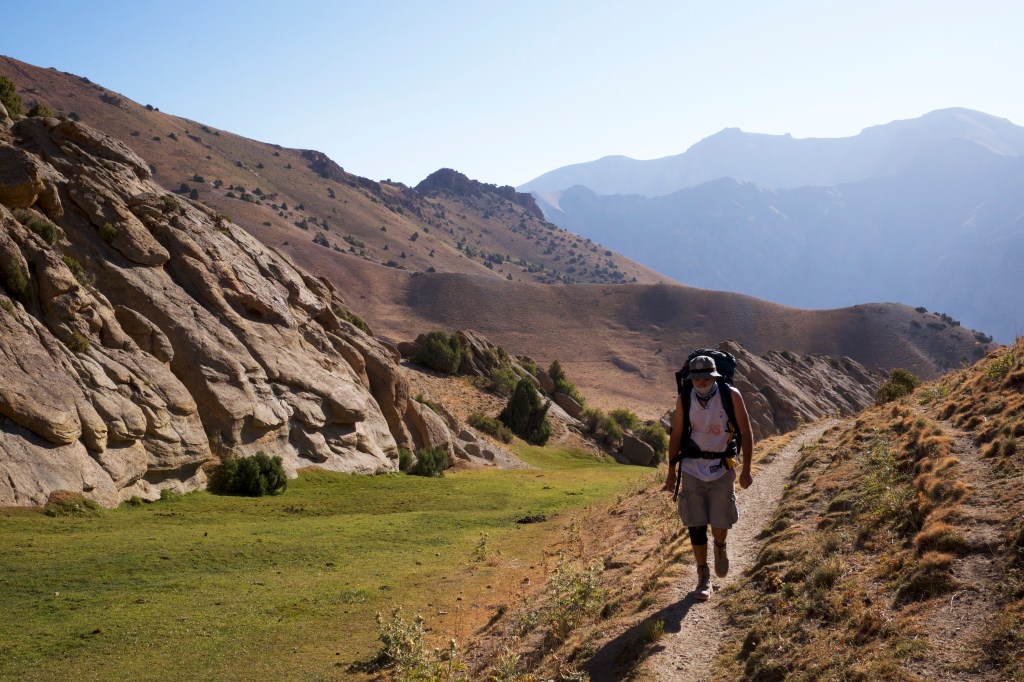
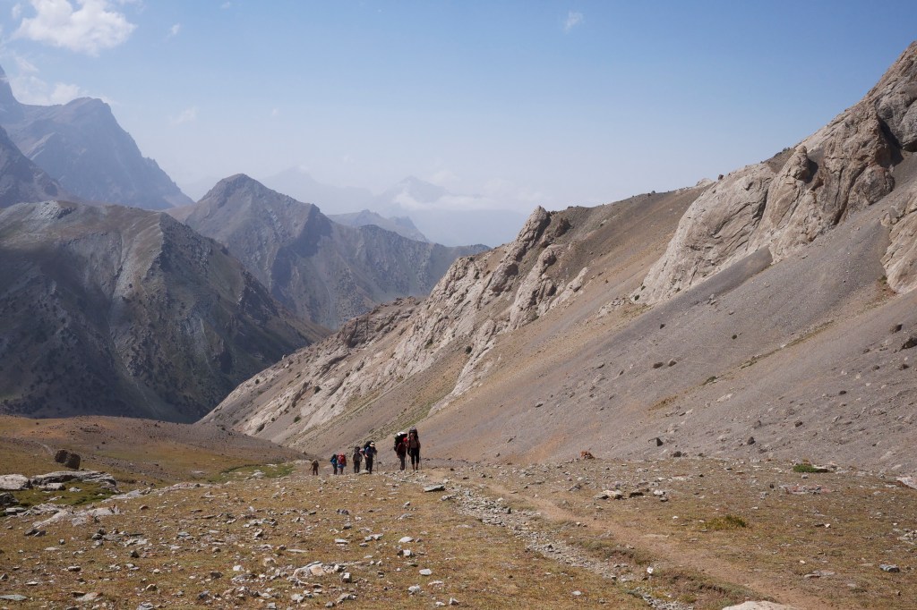
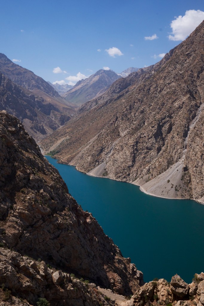
A short 40-minute walk and we arrived at the four bright blue Alauddin lakes, where our 107km trek across the Fanns was to begin. Before making camp Marianne (my French companion) and I set about exploring. The water in the lakes was truly remarkable; each had its own brilliant pallet of crystal blues and greens, and so clear that you could toss a somoni coin ten meters out and you’d still be able see it lying on the bottom.
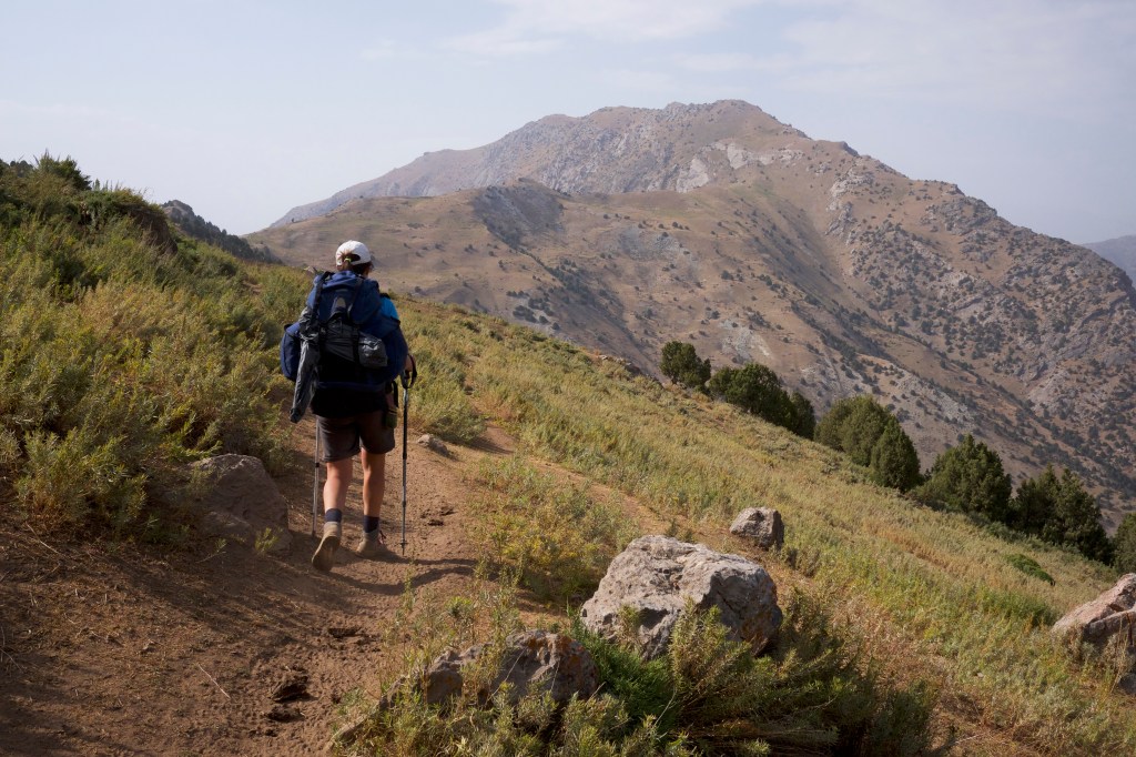
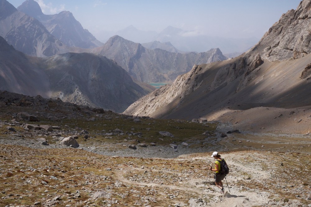
The next day we started at a slow and steady pace up a steep kilometre climb to the first pass at 3,850m. The path wound up through desert pines and past high boulders, on one side there was a huge grey granite slab, on the other was a vertical, craggy, sand-coloured face, and behind us three glacier-topped peaks, the tallest of which is Chimtarga peak; standing at 5,489m it is the highest point in the Fann Mountains.
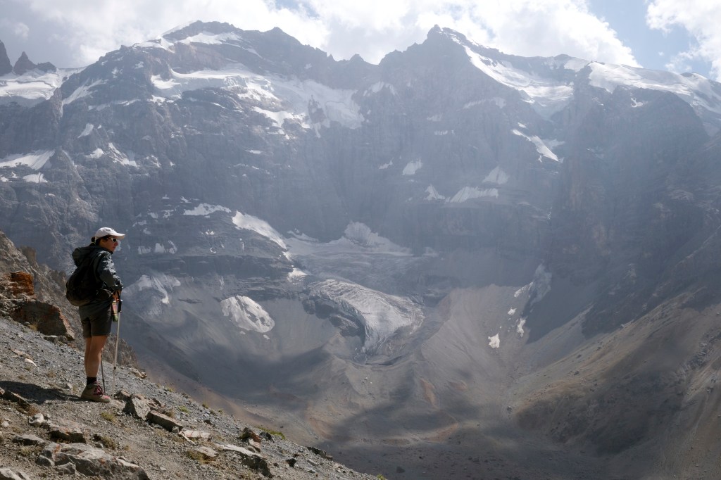
It took us roughly three hours to reach the top. The path became increasingly dry, so by the time we crested the pass, our legs were covered in a thick layer of dust. On the northern side, a large glacier was revealed. Protected by the shade, the snow line came down to level with where we were standing.
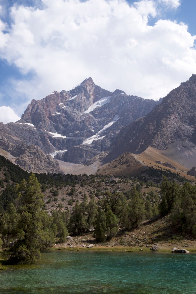
At the bottom of the glacier was a beautiful double lake of turquoise; the kind of aqua-green that you only see in brochures for expensive holidays in the Caribbean. These are Dushakha, twin lakes otherwise known as Maria’s Eyes. We had lunch on the pass, in a rocky spot sheltered from the wind and watched two juvenile eagles bearing bright, white breast-plumage circle us for a few minutes before taking flight over the ridge line.
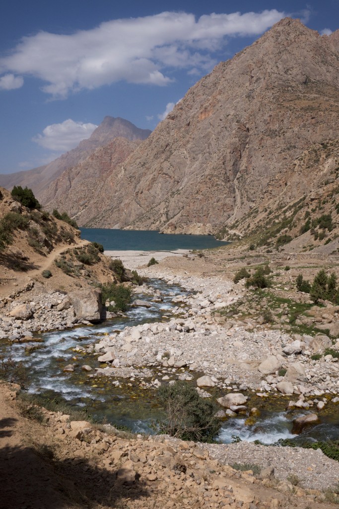
We traversed down and followed a small stream until the full valley floor opened out; a huge flat expanse dotted by juniper trees with trunks twisted like cheese straws. The stream joined many others that funnelled down from all sides to feed a wide, dark blue lake; Bibi Jhonak.
That night it was cold, and the next morning we awoke surrounded by thick, low cloud. We set off early, with the last wisps of vapour still hanging around us, giving the gnarled trees a surreal, ghostly feel. We crossed the river and made our way over the flat plane, past Kulikalon Bolshoi lake on the northern slopes of Chimtarga, and steadily towards our next high pass.
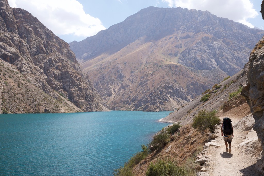
From the valley floor the climb looked like an impassable sheer wall, but as we reached the foot of the pass, a narrow entrance appeared. The hidden path, well-trodden by local shepherds, was remarkably forgiving, and we made our way up a straight diagonal left to right line that moved up across the face until we left the tree line behind us. We stopped on a little rocky outcrop just before the top and admired the incredible view over Kalikulon Valley. Ahead of us rose the twin shadows of Duchokha, two identical peaks standing one in front of the other.
On the other side was a steep, barren decline, which billowed clouds of dust around us as we walked. We wove downward towards Chukurak lake. Though formed entirely naturally, it had the impenetrable green of a fathoms-deep chalk quarry. We lunched on the shore, surrounded by impressive granite walls. Ahead was our next challenge; another steep 900m climb over Ziarat pass, and as far towards Zimtud village as we could make before nightfall.
We climbed quickly and reached the top in time to watch another eagle cruising up and down the thermals that kicked up from either side. In the early afternoon under the shade of the peak, the air was cool and refreshing, and with the help of a light breeze it was perfect for hiking. Around us were hundreds of tall trees with gnarled trunks in the process of shedding their bark. The mixture of mountain shrub land interrupted by clustered Juniper forests felt a lot like hiking in the Andalusian mountains in summer.
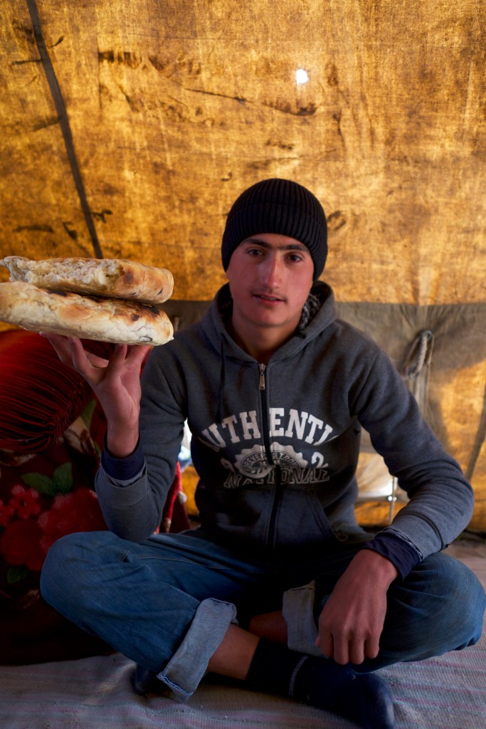
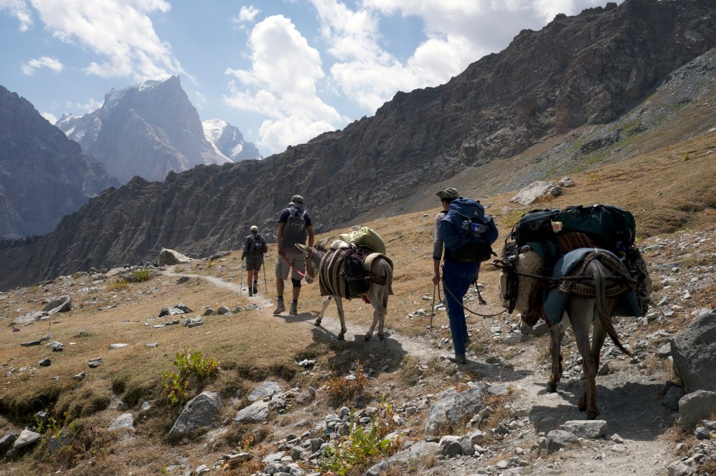
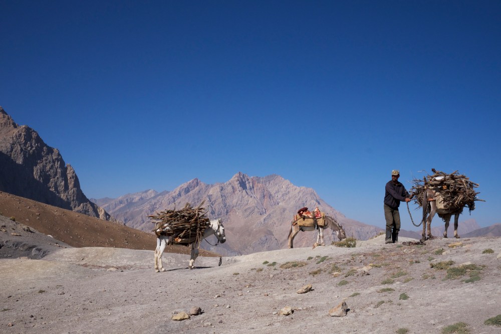
On the exposed pastures cattle, sheep and longhaired goats grazed. Throughout our trek we frequently came across small shepherd camps that housed a single family group. Some were in hundred-year-old buildings made from stone and mud, and others consisted of a few canvas tents stretched over wooden frames. The families live up in the settlements from May to September, and then move with the animals down to their villages for winter. There are still many wolves roving the mountains, so the animals are taken out to graze early in the morning and returned to the safety of camp in the evenings. The herds are usually accompanied by four or five large fighting dogs; their tails and ear flaps removed as puppies to prevent them getting snagged in a brawl with a wolf or mountain lion.
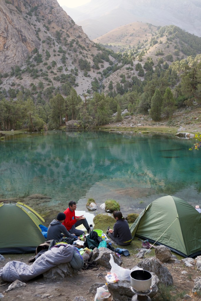
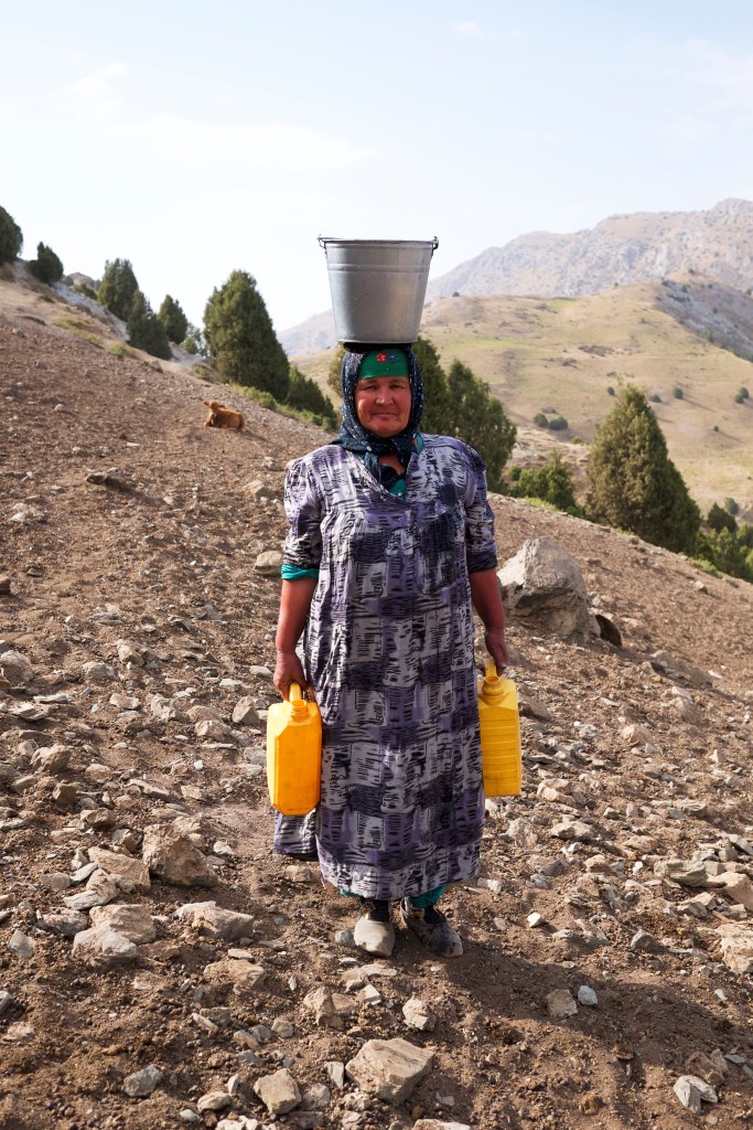
These settlements are always made near freshwater springs, so when not by a lake, we would invariably rest near one. Needless to say that the whole family pulls their weight in these groups, and as we approach one such camp we were greeted by the camp’s grandma carrying a full jerrycan of water in either hand, and a large silver bucket filled to the very brim balanced impossibly on her head.
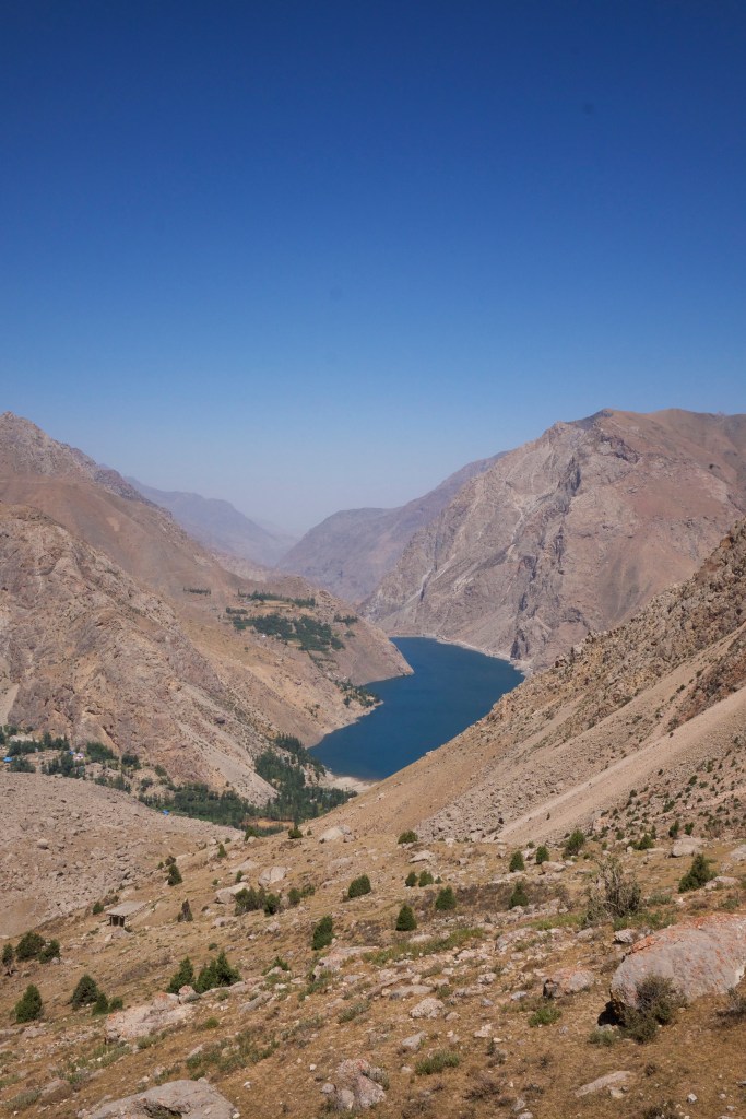
We settled on an outcrop that overlooked the whole valley. It was the most beautiful, peaceful place to relax and make our evening food. From here it felt like we were looking down on the whole of the Fann Mountains.
With two passes in a day and around 17km covered, we were ready for supper, and Denis (our guide) did not disappoint, cooking a delicious vegetarian borscht which was given an extra dollop of greatness when one of the women from the camp brought over homemade Tajik yoghurt to have with it. We went to sleep watching the world from 3000 meters, with the sun setting softly over the valley.
The downside of sleeping beside shepherds is that their animals start early and aren’t shy about making a racket, so we were up at six, just as it started getting light. The Tajik lady who brought us yoghurt the evening before then invited us to breakfast, which consisted of yoghurt, cream, assorted chocolates, homemade raspberry jam, huge chunks of bread, various baked cakes, dried fruits, dried sweet chick peas, nuts and, of course, Chai; Tajik tea. We ate and drank gratefully in their small canvas tent.
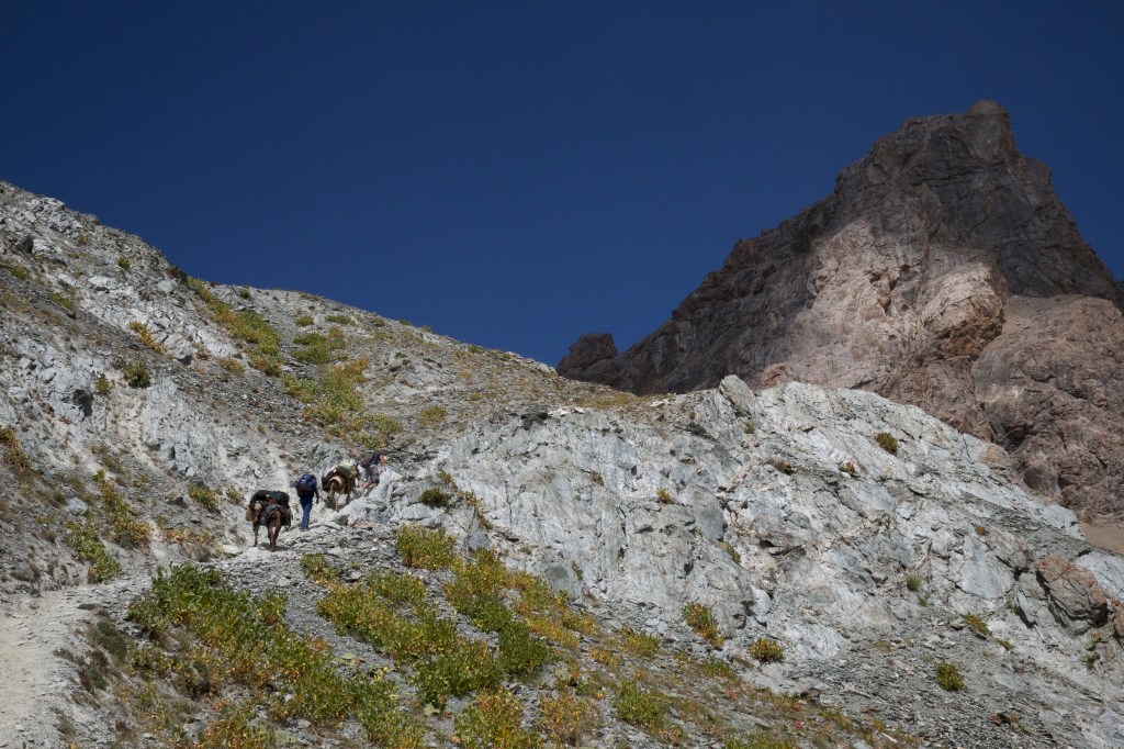
After breakfast, we traversed just below the ridge line until we reached the next pass, still at roughly 3,000m. Below us was Guitan village, and further on, out of sight, Zimtud. We zigzagged down, passing locals on donkeys going up to graze them, or coming down with crops stacked high on their backs. We rested by walled and irrigated gardens with orchards and vegetable patches kept shaded by tall Cyprus trees.
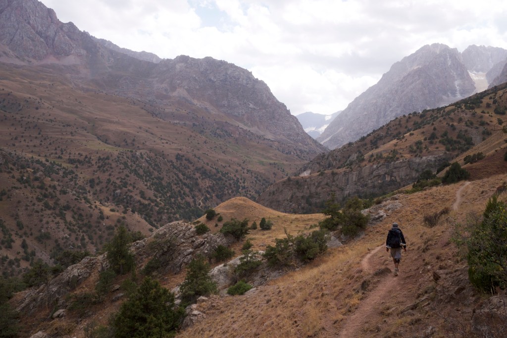
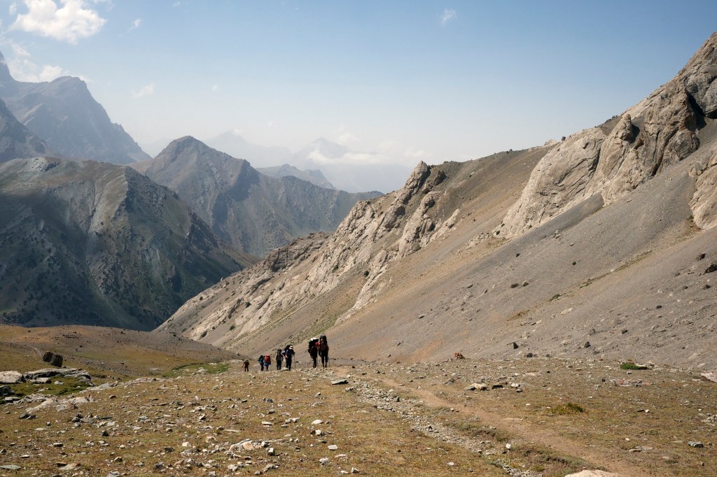
Day five started slowly with hot bowls of kasha eaten by the river. We followed a 4×4 track as far as it would go and then moved back onto the mountain trail, heading into a canyon and deep in the heart of the mountains once again. After lunch in the shade of a copse of tall trees, we started to climb up the valley towards our next pass. In Tovasang Valley there was a much greater abundance and variety of greenery; many different types of conifers, bushes of red berries and rose-hips, small bushes with leaves every colour of autumn and little clusters of pale lilac flowers.
This valley also led to Iskanderkul- yet another famous lake, but one I did not have time for on this trip. Huge sandstone faces with beautiful formations opened out in front of us. One of the best views yet; a truly stunning valley. The tallest of the peaks rose in a semi-circle, creating a cauldron couloir with clouds gathered at the crest, like little fluffy eyebrows hanging over a stony grimace. We climbed the steep ascent of around 900m, passed a small shepherd’s settlement and followed the water until we reached its source. This was the last fresh water before the pass, so we camped for the night.
In the cool morning, chubby partridges perched on the sandstone rocks, while small finches flitted here and there. We climbed for an hour to reach the Tovasang pass, which, appropriately, means ‘wrinkled rocks’ in Tajik. We headed over the pass and into a new valley, cutting across a dangerously slippy slope covered in scree and fine dust from an exposed coal seam, a few times nearly losing our feet.
Keogli Village was in front of us, but we headed to the left aiming for the lowest of the Seven Marguzor Lakes, Hazor Chashma. As we passed a few small shepherd settlements and made our way over to the next pass, the flora changed again, returning to low bushes and ruddy grasses. We hugged the steep hillside and then headed into a huge boulder field, with boulders the size of double-decker busses that made you feel like you were walking in a land of giants. In the distance, beyond the village, we could see the huge expanse of the sixth lake; its water like a vast blue mirror.
The Seven Lakes are a string of sapphire gems connected by an impossibly clean and clear river. The rocks on the river bed sparkle, and the whole thing has a blue tint that makes it look like it’s artificial; a giant filtered theme park, too perfect to be true.
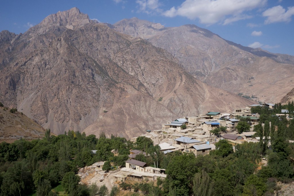
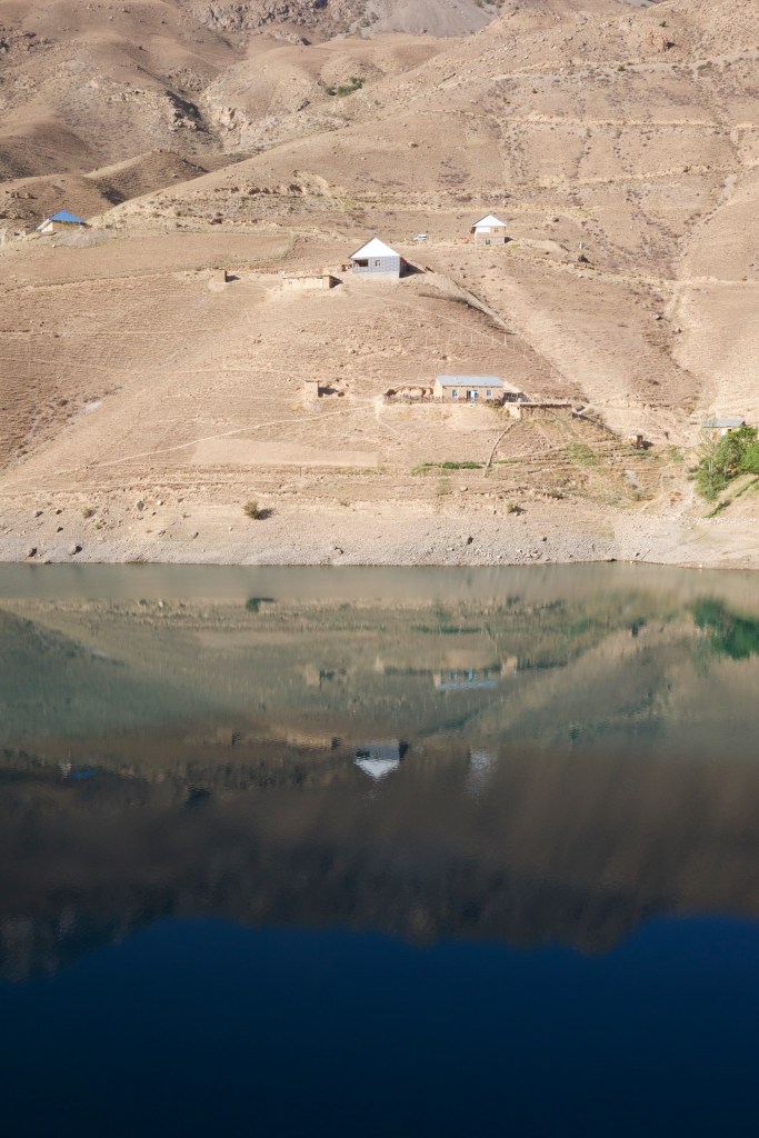
Along the river and beside the lakes, small villages have gathered around the water. We followed a road cut into white, chalky rocks. Beside the azure water with the sun overhead we could have easily been on the coast, perhaps somewhere in Greece or Italy.
As we approached the fourth lake the light was getting lower, and was playing beautiful tricks on the surrounding mountains; painting colours of rose, gold and orange. The fourth lake is the middle lake, hence its name, Nonof, meaning ‘belly button’. From there we headed up the valley to our rest spot- a hostel by the river, which was a dream. A dream with beer in the cool shade. Having walked 36km, it was our longest day by some margin, making the shower and hot food even more welcome.
On our seventh and final day we worked our way along the last few lakes; Hushor, Soya, and finally Mijon, which had deep colours of purple and red that seemed to shift hues as we watched. After the final lake we walked a few kilometres to the largest village in the area, Shing. We picked up a taxi to Penjakent and the border with Uzbekistan, and from there it was just 30km to the ancient city of Samarkand.
The land border at Penjakent reopened in March for the first time in 30 years. While I was in the country, the president of Tajikistan, Emomali Rahmon, visited the Uzbek capital and announced greater cooperation along with new direct flights between their major cities; the first time a president of Tajikistan had ever visited its western neighbour. These are all signs of Tajikistan becoming a more open and welcoming proposition for tourism and business.
My own experience is that Tajikistan is a country rich with culture and welcoming, friendly people; from enthusiastic city-goers to the broad-smiling shepherds. Add to that some of the most incredible mountains in the world, and I cannot recommend it highly enough. As with any relatively poor country (roughly half of their GDP is money sent home from Tajiks working abroad) that is rich in natural resources above and beneath the ground, Tajikistan will face challenges in developing long-term sustainable growth and a tourism sector that doesn’t damage the environment or its cultural identity. But there are so many positives for Tajikistan to build on- not least their strong sense of community. 2018 is Tajikistan’s Year of Tourism, and I hope it boosts what is already a growing reputation; encouraging more people to discover this little known but remarkable destination in the heart of Asia.
WHEN TO GO
In mid-June to September temperatures in the cities sail over 40oC, but the high mountains are fresh and rainfall is extremely low. Spring months in the Fanns, when the valleys are green and blooming, are said to be incredible; though be warned that heavy showers can cause landslides, blocking roads.
HOW TO GET THERE
Fly into Dushanbe and arrange your travels from there. Visa application has recently been streamlined and made electronic, so the process is quick and easy. www.evisa.tj
WHERE TO STAY
In Dushanbe there are hotels and hostels to suit all budgets. In the mountains, homesteads are the cheapest and friendliest (and often the only) choice. Just ask when you get into a village.
HOW HARD
Moderate. If you are hiking in the Fanns, and aren’t braving the winter ice climbs, then the terrain is largely very accessible and requires little in the way of specialist equipment.
WHO TO GO WITH
Denis Galimianov from Hike Tajikistan is a fantastic local guide who speaks excellent English. He is a specialist in the Fann Mountains and areas surrounding Dushanbe, but can also arrange for trips anywhere in Tajikistan. Search ‘Hike Tajikistan’ on Facebook or email hiketajikistan@gmail.com.